


BELL PLAIN Voting District, Marshall County, Illinois
About
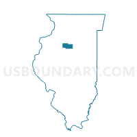
Outline

Summary
| Unique Area Identifier | 573504 |
| Name | BELL PLAIN Voting District |
| County | Marshall County |
| State | Illinois |
| Area (square miles) | 36.90 |
| Land Area (square miles) | 36.81 |
| Water Area (square miles) | 0.09 |
| % of Land Area | 99.76 |
| % of Water Area | 0.24 |
| Latitude of the Internal Point | 40.97340510 |
| Longtitude of the Internal Point | -89.20979740 |
Maps


Graphs
Select a template below for downloading or customizing gragh for BELL PLAIN Voting District, Marshall County, Illinois


Neighbors
Neighoring Voting District (by Name) Neighboring Voting District on the Map
- BENNINGTON 1 Voting District, Marshall County, IL
- BENNINGTON 2 Voting District, Marshall County, IL
- CAZENOVIA 2 Voting District, Woodford County, IL
- CLAYTON Voting District, Woodford County, IL
- EVANS 1 Voting District, Marshall County, IL
- HOPEWELL Voting District, Marshall County, IL
- LINN Voting District, Woodford County, IL
- RICHLAND Voting District, Marshall County, IL
- ROBERTS Voting District, Marshall County, IL
Top 10 Neighboring County Subdivision (by Population) Neighboring County Subdivision on the Map
- Cazenovia township, Woodford County, IL (1,768)
- Bennington township, Marshall County, IL (1,669)
- Evans township, Marshall County, IL (1,322)
- Roberts township, Marshall County, IL (925)
- Clayton township, Woodford County, IL (697)
- Hopewell township, Marshall County, IL (562)
- Richland township, Marshall County, IL (446)
- Bell Plain township, Marshall County, IL (400)
- Linn township, Woodford County, IL (287)
Top 10 Neighboring Place (by Population) Neighboring Place on the Map
Top 10 Neighboring Unified School District (by Population) Neighboring Unified School District on the Map
- Fieldcrest Community Unit School District 6, IL (6,671)
- Midland Community Unit School District 7, IL (5,415)
- Roanoke-Benson Community Unit School District 60, IL (3,443)
- Lowpoint-Washburn Community Unit School District 21, IL (2,511)
Top 10 Neighboring State Legislative District Lower Chamber (by Population) Neighboring State Legislative District Lower Chamber on the Map
Top 10 Neighboring State Legislative District Upper Chamber (by Population) Neighboring State Legislative District Upper Chamber on the Map
Top 10 Neighboring 111th Congressional District (by Population) Neighboring 111th Congressional District on the Map
Top 10 Neighboring Census Tract (by Population) Neighboring Census Tract on the Map
- Census Tract 302, Woodford County, IL (2,989)
- Census Tract 9614, Marshall County, IL (2,921)
- Census Tract 301, Woodford County, IL (2,580)
- Census Tract 9615, Marshall County, IL (2,276)